Cycling the route
The John Muir Way makes a fantastic cycle route usually taking about 4 or 5 days, depending on your temptation to linger and explore.
It's intended to provide a pleasant and sometimes challenging cycle through the countryside, not – like many traditional cycle routes – an efficient way from A to B on a bike. Most of the route follows cycle paths and quiet back roads, although unavoidably some short sections are on busier roads which aren't so suitable for the less experienced.
What type of bike should I use?
We strongly recommend using a mountain bike, hybrid, sturdy tourer or gravel bike with good puncture resistant tyres. For comfort and to reduce the chances of a puncture on the rougher sections, go for tyres at least 30mm wide.
In some places there are short steep and rough sections, and individual obstacles like kerb edges and tight corners, which will be challenging if you have a heavily-laden touring bike. The surfaces and gradient, or simply the presence of pedestrians, may at times mean that cyclists have to push.
If you'd like a leisurely cycle, try hiring an electric bike and cruise along the route.
What route should I follow?
The whole route is waymarked and for the most part you'll be on the shared walking and cycling route. However you'll find in some places the waymarked cycle route diverges from the walking route on cycling 'braids', shown in green on the interactive maps.
These usually provide smoother and flatter options to the walking route which may be steep and bumpy or involve stairs. The braids are more suited to touring bikes with panniers. In some places, such as on the Antonine Wall, the braids are there to discourage cycling on a particularly vulnerable surface.
Many of the waymarked walking sections where the cycle route diverges are actually quite suitable (and fun) to ride but you'll need to be on a bike suited to off-road riding, such as a gravel or mountain bike. This particularly applies to sections 1 and 2 where the walking route surface can be rough and steep.
You'll find maps of each section on our maps page.
Bikepacking the route
For a good mixture of paved/unpaved riding, check out the version of the route put together by Bikepacking Scotland, where you'll find route maps and bikepacking tips plus GPX map downloads.
Sharing the path
As the majority of the John Muir Way travels along shared paths, there are many sections used for activities from dog walking and horse riding to fishing and commuting.
Please always check your speed when there are other people around and alert path users to your presence. It's highly recommended that your bike has a bell fitted and don't be afraid to use it! On narrow paths where it's difficult to pass safely, please also be prepared to dismount and give way to walkers.
John Muir preferred to 'saunter' rather than 'hike' and an equally relaxed pace on the bike through the busier sections will be appreciated by all. For more about cycling off road and on multi-use paths, please visit the Scottish Outdoor Access Code website.
Following the signs
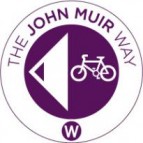
The John Muir Way is signed in both directions. At braid junctions there will be separate signs for both walkers and cyclists. The sign below, with a bike and W, would be for cyclists heading west.

In some places the John Muir Way logo is incorporated into other signs such as the Sustrans NCN signs. These can be harder to spot when travelling at speed on a bike!
Bike shops and hire
There are numerous bike shops along the length of the route that offer a valuable resource for spares and repairs. Some also offer bike hire.
To find out more, visit the Plan Your Trip page.
Bikes and public transport
Experience tells us that spaces for bikes on trains, especially from Dunbar to Edinburgh can be limited so it is best to book ahead and travel off peak to guarantee your space.
