John Muir Way accessibility information now available
11 May 2022
We're pleased to announce the publication of a new accessibility guide to the John Muir Way.
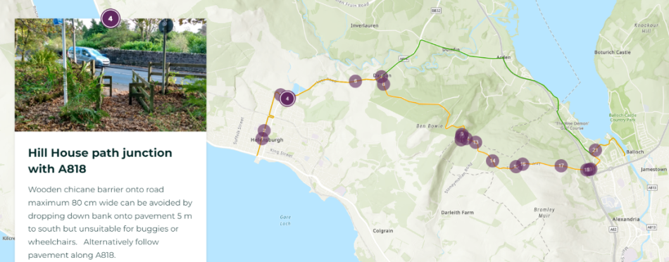
All ten sections of the coast to coast route were audited and a series of storymaps produced. These provide a step by step guide to the accessibility of the John Muir Way and have been produced to help anyone interested in using the route to assess for themselves which sections are suitable for their intended use, level of fitness and physical mobility. The maps and notes are equally relevant to walkers, cyclists, horse riders, people using mobility aids, wheelchairs or pushing buggies. Locations of features that may restrict accessibility, or which most people would struggle to negotiate with a wheelchair or horse, are identified on the maps. The accompanying text and photos will help users to assess whether any of these may limit their use of the route.
Click here to access the storymap guide.
You'll also find links to each section's storymap within each of the ten Route section pages.
Example of a storymap feature in section 1 (Helensburgh - Balloch)
The storymaps were funded by NatureScot and created by the Green Action Trust with content supplied by countryside management consultant Vyv Wood-Gee from a survey of the John Muir Way in 2021. The survey was commissioned by the Green Action Trust and funded by the Scottish Government and the European Community LEADER 2014–2020 Programme. Our thanks go to all who contributed.

